Phoenix Sonoran Desert Preserve: Hiking, Mountain Biking and Horseback Riding

Why You Should Go
The City of Phoenix’s newest effort to protect the pristine Sonoran Desert wilderness within the City’s boundary could become your favorite outdoor playground. For many North Phoenix residents, from Tramonto in the north to Norterra in the south, it’s literally just beyond the backyard, or a short walk from the front door. The huge yet accessible park is ideal for those who wish to take a long hike, or a short evening walk, and it also offers great opportunities for photographers and birders.
When To Go
Late October through late May are the best months to spend any serious time in the desert. Extreme heat of the summer months can make anything but an early morning outing potentially dangerous.
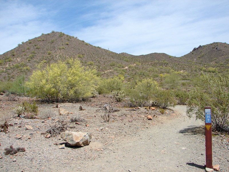
Trails (Trail Map)
From Apache Wash Trailhead (1600 E. Sonoran Desert Drive)
- Apache Loop Trail – 5.59 miles
- Apache Vista Trail – 0.5 miles
- Badger Brawl Trail – 3.39 miles
- Cliff Walk Trail – 2.88 miles
- Esplanade Trail – 3.4 miles
- Ocotillo Trail – 6.25 miles
- Ridgeback Trail – 1.53 miles
- Ridgeback Overlook Trail – 0.24 miles
- Sidewinder Trail – 6.98 miles
- West Skip Rimsza Paseo – 1.9 miles
- East Skip Rimsza Paseo – 3.1 miles
From Desert Hills Trailhead (705 W. Carefree Highway)
- Ocotillo Trail – 6.25 miles
- Sidewinder Trail – 6.98 miles
From Desert Vista Trailhead (1900 W. Desert Vista Trail)
- Bobcat Trail – 1.01 miles
- Cactus Wren Trail – 1.41 miles
- Desert Tortoise Trail – 1.1 miles
- Dixie Mountain Loop Trail – 3.82 miles
- Dixie Summit Trail – 0.22 miles
- Great Horned Owl Trail – 3.1 miles
- Hawk’s Nest Trail = 0.39 miles
- Union Peak Trail – 0.45 miles
- Western Vista Trail – 0.34 miles
- Valle Verde Trail – 1.2 miles
Be Safe
Good shoes, sun screen, a wide-brimmed hat and a signaling device are always a must when visiting any desert area any time of year. Be sure to take an adequate supply of water and tell someone where you are going before beginning your outing into the preserve or any desert area.
Dogs are welcome in the preserve but must always remain on a leash. Be sure to clean up and carry out any waste from your four-footed friend.
History
The citizens of Phoenix have had a long history of preserving their urban mountains for the enjoyment and recreational by all citizens. As early as 1920 when the city covered only 5.1 square miles, Phoenix leaders saw the benefit of acquiring mountain lands for picnicking, horseback riding and hiking.
By 1925 city efforts resulted in the acquisition by Presidential decree of 13,000 acres of mountain land south of the downtown area. The city paid $17,000 for the land that is known today as South Mountain Park, which now encompasses some 16,500 acres and is the largest municipal park in the United States.
By 1959 the City had grown to 187 square miles and civic leaders once again began acquiring mountain lands for preservation. In 1964 the land known as Papago Park was purchased for $3,529 and became home to both the Phoenix Zoo and Desert Botanical Gardens.
In the late 1960s Senator Barry Goldwater led the fight to purchase 350 acres of land to save the summit of Camelback Mountain. More than 350,000 hikers each year now follow the Camelback Summit Trail to the mountain’s summit to enjoy the view.
In January 1972, Phoenix had grown to 248 square miles and the City Council established the Phoenix Mountain Preserve to protect more of the natural mountain environments and landscapes from further development. Today the 7,500 acre Phoenix Mountain Preserve protects such mountains as Piestewa Peak, Shaw Butte, North Mountain and the Dreamy Draw Recreational Area.
For almost 100 years the citizens and elected officials of Phoenix have had the foresight of preserving the urban mountain areas of this region of the Sonoran Desert. The Phoenix Sonoran Preserve is a continuation of that long-held vision.
COST: free
HOURS: Check website for trailhead hours


